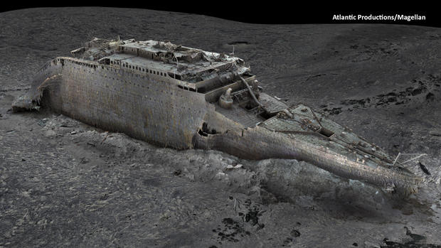
Brand new images of the Titanic reveal unprecedented views of the shipwreck and may shed new light on how the iconic liner sank more than a century ago.
The first ever full-sized digital scan of the ship liner's wreckage, which lies 12,500 feet below water on the floor of the Atlantic Ocean, has been developed using deep sea mapping.
Analysts hope that the images will provide fresh insight into how the Titanic went down on April 15, 1912 after the liner struck an iceberg during its ill-fated maiden voyage.
The disaster — which has been immortalized in popular culture through documentaries, books and a Hollywood blockbuster — killed more than 1,500 people on board – roughly 70% of the ship's passengers and crew.
The scan was carried out last year by Magellan Ltd, a deep-sea mapping company, in partnership with Atlantic Productions, a London-based company that is currently making a film about the project.


No comments:
Post a Comment